Kerið Crater: Entry Fee, Walks and How to Visit From Reykjavik
Kerið is the smallest headline stop on the Golden Circle and the only one with a ticket gate. Here is what the fee buys, how long the two walks take, and when the crater is worth the twenty minutes.
If you prefer not to drive Route 35, compare Reykjavik departures that explicitly include Kerið and leave enough time for the rest of the Golden Circle. Explore Golden Circle And Kerið
Booking Choice: Kerið is a short but distinctive Golden Circle stop. Self-drivers gain timing flexibility; guided options handle Reykjavik transport and explicitly combine the crater with Þingvellir, Geysir and Gullfoss. View Golden Circle And Kerið
What the Golden Circle actually costs at the gate
Kerið is the only paid entry on the loop, and guided days usually cover it for you.
What is Kerið crater, and why are the walls red?
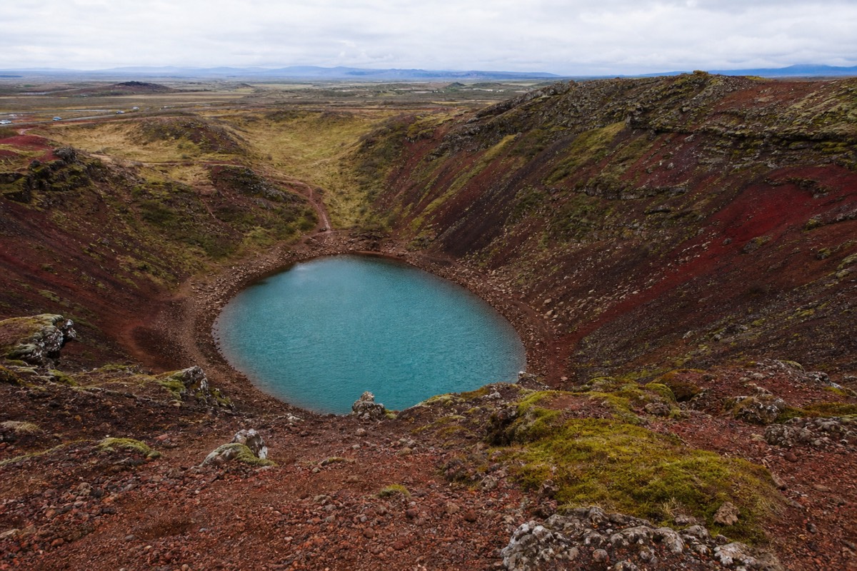
Kerið is a volcanic crater roughly 3,000 years old, sitting beside Route 35 in the Grímsnes area about 75 km from Reykjavik. The bowl runs around 270 metres long, 170 metres wide and 55 metres deep, with iron-red scoria walls, green moss on the slopes, and a shallow blue-green lake at the bottom.
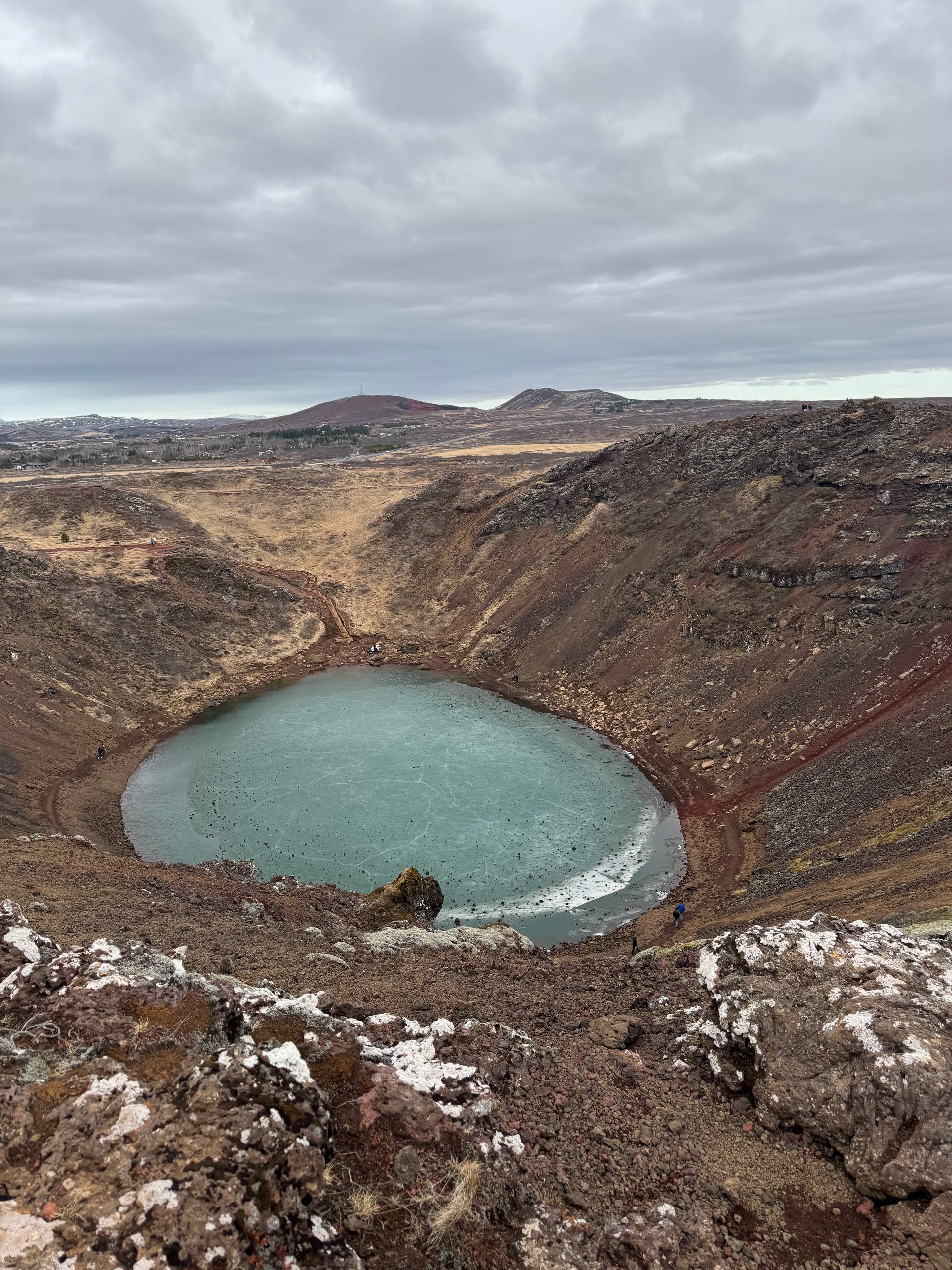
The colour is the whole reason people stop. Most Icelandic rock reads black or grey, so a crater lined in rust and brick red registers as something close to an error in the landscape. The red is oxidised iron in the scoria, the loose cindery rock thrown out when the crater was active. Moss has taken hold in the gentler sections, which puts a green stripe across the red, and the lake at the base turns anything from milky turquoise to slate depending on light and sediment.
The lake is not fed by a stream. It is the local water table showing through the floor of the bowl, which is why the water level moves through the year and why the shoreline you photograph in May can sit a metre or two off where it sits in February. Nothing drains out visibly. In dry stretches the water pulls back and leaves a pale rim of exposed sediment.
Kerið belongs to a row of craters in the Grímsnes volcanic field rather than standing alone, which is easy to miss from the car park. The neighbours are lower, scruffier and unfenced, and none of them holds water the way this one does. Geologists have argued for decades over whether the bowl formed by a straightforward explosive eruption or by the cone emptying its magma chamber and collapsing into the void. The collapse explanation is the one most guides tell, and it fits the shape: a clean oval with a floor, not a shattered pit.
How much does it cost to visit Kerið, and why is there a fee at all?
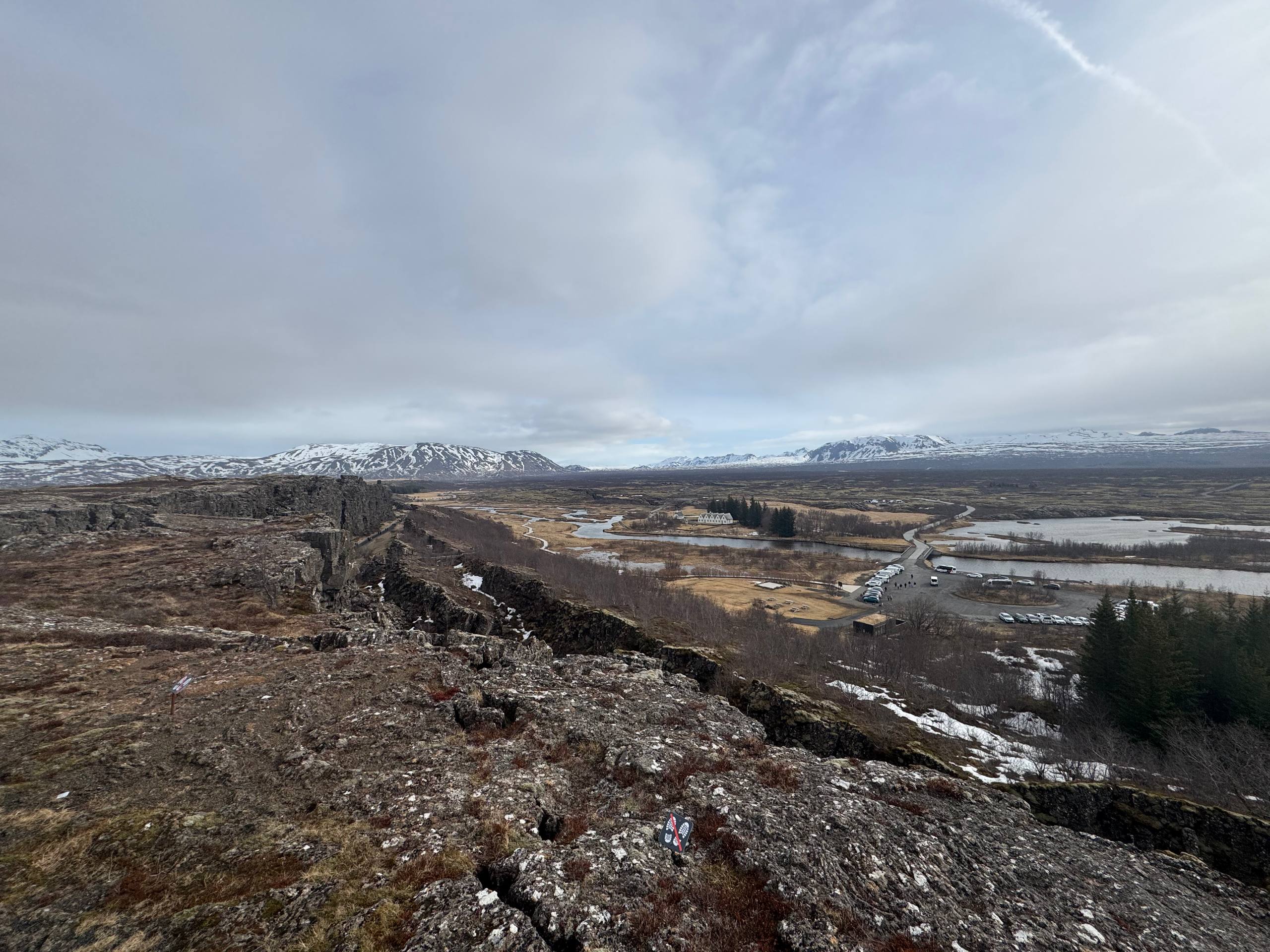
Adult entry runs around ISK 600 to 700 at the gate, children under 12 go free, and parking costs nothing. Kerið is on private farmland, so the landowners charge for access and maintain the paths from it. Þingvellir, Geysir and Gullfoss charge nothing to enter, though Þingvellir parking is around ISK 1,000 per car.
That small fee causes more confusion than any other line item on a Golden Circle day. Iceland does not generally charge admission to its natural sites, so travellers arrive with a mental model of free entry everywhere and then meet a hut with a card reader. The land here is owned privately, and the owners built and maintain the stairway, the rim path, the toilets and the car park. Nobody is charging you to look at a volcano. You are paying for the infrastructure that keeps 500 people a day from trampling the rim into mud.
| Golden Circle stop | What you pay | What the money covers |
|---|---|---|
| Kerið crater | Around ISK 600 to 700 per adult; under 12 free; parking free | Private land access, stairway, rim path, toilets |
| Þingvellir National Park | Entry free; parking around ISK 1,000 per standard car | One ticket covers the main lots for the whole day |
| Geysir geothermal area | Free | Nothing to pay; the café and shop are separate |
| Gullfoss waterfall | Free | Nothing to pay; paths and viewing platforms maintained publicly |
Prices move, and the gate takes cards rather than cash in most conditions. Treat the figures above as the 2026 ballpark and check the official site before you build a budget around them. If you are working out the wider cost of a Golden Circle day, our page on what a Golden Circle tour includes breaks down which fees an operator absorbs and which ones stay in your pocket until you arrive.
Is Kerið included on Golden Circle tours from Reykjavik?
On most guided Golden Circle days, yes. Kerið appears as a fourth stop on the return leg toward Reykjavik and the entry fee is normally built into the ticket price. Some very cheap coach itineraries drop it to save 30 minutes, so check the stop list before booking if the crater is a priority.
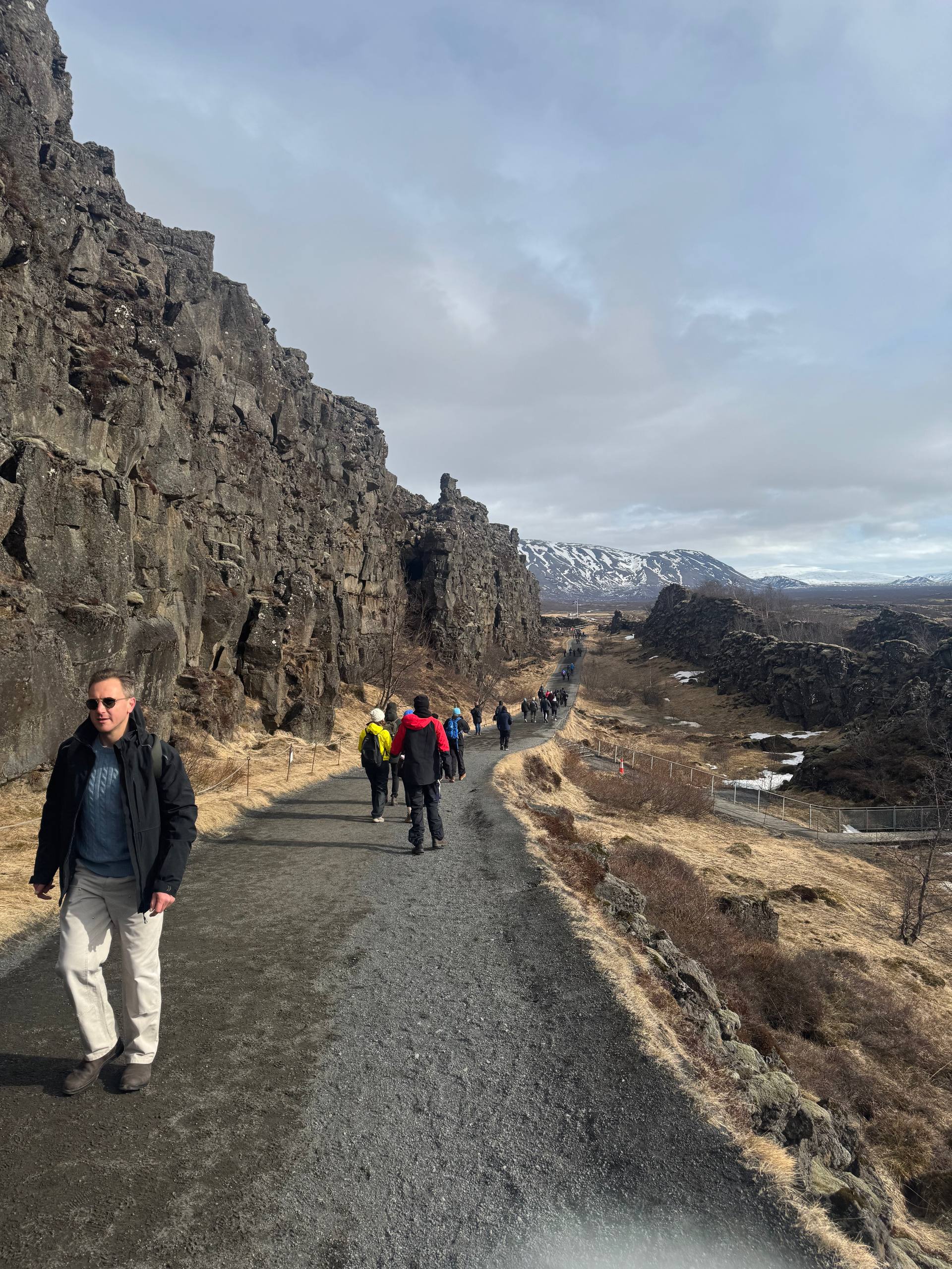
The reason it sits at the end is pure road geometry. The classic loop runs Þingvellir, then Geysir, then Gullfoss, and the return road passes through the Selfoss area where Kerið happens to be. Adding it costs a coach almost nothing in extra kilometres. Dropping it saves half an hour, which is exactly what an operator running a tight express schedule wants to save.
The classic Golden Circle day we list covers Þingvellir, Strokkur, Gullfoss and Kerið, with the crater and park entry fees inside the price, then finishes with a Blue Lagoon soak. That is the version most first-time visitors want: one 11-hour day, four sites, nothing extra to pay at any gate. Our day trips from Reykjavik tours all work the same way on fees, with what you pay on the day spelled out on the listing rather than discovered at a hut in a field.
| Tour style | Kerið included? | Time at the crater | Watch for |
|---|---|---|---|
| Small-group minibus, full day | Almost always | 25 to 30 minutes | Enough time for the rim loop plus the stairs |
| Large coach, standard loop | Usually | 20 to 25 minutes | Queue at the stairway when two coaches land together |
| Express or budget coach | Often dropped | None | Read the stop list; the loop can be sold without it |
| Self-drive | Your call | As long as you like | Gate hours are daylight-led in deep winter |
| Private tour | On request | Flexible | Ask for the counterclockwise route to dodge coach timing |
How long do you actually need at Kerið?
Twenty minutes covers the essentials: the view from the rim above the car park, a short walk along the edge, and photographs. Forty minutes lets you do the full rim circuit and descend the stairway to the water. An hour is generous unless you are shooting in changing light or travelling with small children.
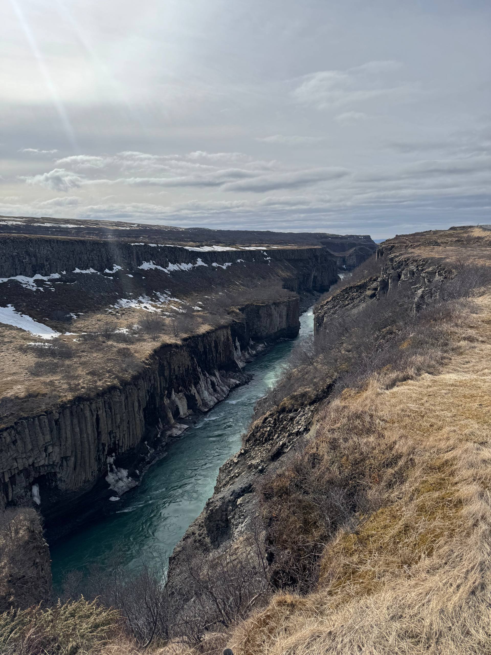
Kerið is small, and that is the point of it. After Gullfoss, which asks for an hour and a stiff walk, a compact crater you can see whole from one spot works as a decompression stop rather than another endurance test. Groups tend to split: half go straight down the steps, half walk the rim, and everyone meets back at the bus.
| What you do | Time to allow | Ground underfoot | Worth it when |
|---|---|---|---|
| Rim viewpoint by the car park | 5 to 10 minutes | Flat gravel, buggy and wheelchair passable in dry weather | You are short on time or the wind is brutal |
| Full rim circuit | 15 to 20 minutes | Compacted path, some loose scoria, no railing on the far side | You want the crater from every angle and the light is moving |
| Stairway down to the lake | 15 minutes return | Built steps, uneven, slick when wet or frozen | You want the scale from below and the water colour up close |
| Rim circuit plus stairway | 35 to 45 minutes | Both of the above | You are self-driving and set your own clock |
| Photography session | 60 minutes plus | Both, repeatedly | Low sun on the red walls, which needs patience |
The stairway is the part people underestimate. From the rim the drop looks trivial. Standing at the waterline with 55 metres of red wall curving above you is a different experience, and it is the shot that separates a Kerið photograph from a postcard. Coming back up is a short, sharp climb that anyone with a knee complaint will feel.
Where is Kerið and how do you get there from Reykjavik?
Kerið sits on Route 35 between Selfoss and Reykholt, roughly 75 km from Reykjavik and about an hour of driving on paved road with no mountain passes. Coming from the Golden Circle it is 15 minutes south of the Skálholt junction. There is a large signed car park on the east side of the road.
The drive is one of the easiest on the whole south-west network. Route 1 east out of the city, then Route 35 north at Selfoss, and the crater appears on your right behind a low ridge that hides it completely until you are at the entrance. That concealment is why many self-drivers sail past. The sign is modest and the crater is invisible from the road.
| From | Distance | Realistic drive | Notes |
|---|---|---|---|
| Reykjavik | About 75 km | 1 hour | Route 1 to Selfoss, then Route 35 north |
| Þingvellir National Park | About 60 km | 50 to 60 minutes | Route 36 to 365 to 35, the standard loop direction |
| Geysir and Strokkur | About 40 km | 35 minutes | Straight down Route 35 on the return leg |
| Gullfoss | About 50 km | 45 minutes | The last stop before Kerið on most itineraries |
| Selfoss town | About 15 km | 15 minutes | Nearest fuel, supermarket and proper lunch |
| Secret Lagoon at Flúðir | About 35 km | 30 minutes | Common pairing on a slow self-drive day |
Winter driving on this stretch is undramatic by Icelandic standards, but undramatic is not the same as safe. Route 35 gets ice and drifting snow, and the car park is exposed. Check road conditions the morning you go, and if the forecast carries a wind warning, remember that opening a car door in a 25 m/s gust is how rental companies end up billing people for hinges. If you are still deciding how to run the day, our comparison of self-drive vs guided covers the trade-off in the seasons when this matters most.
Rim path or stairway: which walk should you take?
Take the rim path if you want the crater as a shape and the surrounding lava field as context. Take the stairway if you want scale and colour. With 25 minutes on a tour stop you can do the rim loop or the stairs comfortably, but doing both means moving briskly and skipping the far viewpoint.
The rim path runs the full circumference on compacted gravel. It is genuinely easy walking, though the far side has no barrier between the path and a very long drop, so it is not a place to let a five-year-old run ahead. The reward is the view back across the bowl with the lake in front and the flat farmland behind, which is the only angle that shows how abruptly the crater interrupts the countryside.
The stairway drops from the north-west side to a small shore area. Steps are built and maintained but uneven in the way that hand-laid stone always is. In wet weather they are slippery; in frost they are worse, and a walking pole earns its place. At the bottom the acoustics change, wind drops away, and the red walls close in. Most people go quiet down there for a minute, which tells you more than any description.
One practical note that decides the order for a lot of groups: if a coach has just arrived, go down first and walk the rim afterward. The stairway is single file in places and a queue on it wastes half your stop.
When is Kerið at its best through the year?
Late spring and early autumn give the strongest combination of colour and quiet. May and September deliver low light on the red walls, moss at full green, an ice-free lake and thinner crowds. Midsummer is busiest, midwinter can be beautiful in snow but the stairway is often the limiting factor.
| Month | Crater conditions | Crowd level | Verdict |
|---|---|---|---|
| January to February | Snow on the rim, red walls partly covered, lake often frozen; 4 to 5 hours of daylight | Low | Striking but short-windowed; stairs may be closed or unsafe |
| March to April | Melt exposes the red again, lake refilling, wind at its most tiresome | Low to moderate | Good value; bring the wind layer you would take to the coast |
| May | Moss greening, water high, 14 to 18 hours of daylight | Moderate | The sweet spot for colour contrast |
| June to July | Full green, long light, warmest ground | High, especially 11 AM to 3 PM | Go early or late in the day; midday is coach hour |
| August | Colour still strong, light softening | High | Excellent if you can visit after 5 PM |
| September to October | Autumn tones, low sun raking the walls, lake settling | Moderate to low | Best month for photographs |
| November to December | First snow, very short days, gate hours shrink | Very low | Fine as a quick stop inside a winter Golden Circle day |
Time of day matters more than month for crowding. Coaches run the loop clockwise from Reykjavik and reach Kerið in the late afternoon, so a self-driver who inverts the route and hits the crater first thing gets it almost empty. That inversion is the single most useful trick on the entire Golden Circle, and it applies just as well to Þingvellir National Park, where the morning car parks fill before ten.
What Kerið is like in winter, and when to skip it
In snow the crater reads as a white bowl with red streaks where wind has stripped the walls bare, and the lake often carries ice. The rim path stays walkable in most conditions. The stairway is the weak point: frozen steps close it in practice, whether or not a sign says so.
Reykjavik gets roughly four to five hours of usable daylight around the winter solstice, with sunrise near 11:20 and sunset near 15:30. A guided Golden Circle day in that window is a race against the light, and the crater is the stop that gets trimmed. If you are self-driving in December or January, put Kerið early rather than last, because arriving at 15:20 means photographing a dark hole in the ground.
Skip it entirely if you are travelling with someone whose mobility makes uneven gravel a problem and the weather has turned, or if the day is already overstuffed. Kerið is a good stop, not a destination. Nobody flies to Iceland for it. Our page on day trips from Reykjavik in winter covers which routes still make sense when the daylight budget is that tight.
What should you bring for the stop?
Windproof outer layer, shoes with grip, and a card for the gate. That is the whole list in summer. In winter add microspikes or at least a boot with a real tread pattern, because the stairway and the packed sections of the rim path turn glassy after a thaw and refreeze cycle.
| Item | Why it matters here | Season |
|---|---|---|
| Windproof shell | The rim is exposed on all sides with no shelter anywhere on the loop | Year-round |
| Grippy footwear | Loose scoria on the path, uneven stone on the stairway | Year-round |
| Microspikes | Frozen steps are the main reason people turn back | November to March |
| Payment card | The gate is card-first; do not rely on carrying cash | Year-round |
| Wide lens or a phone panorama | The bowl does not fit in a standard frame from the rim | Year-round |
| Hat and gloves | Wind chill at the rim runs several degrees below the car park reading | September to May |
There is no café at the crater and the toilets are basic. Selfoss, 15 minutes south, is where the Golden Circle traffic eats. Anyone planning a longer day out of the capital will find the same logic in our guide to the Reykjadalur hot spring river, another south-west stop where the facilities are thinner than the visitor numbers suggest.
How does Kerið compare with Iceland's other reachable craters?
Kerið is the only easily reached crater near Reykjavik that holds a permanent lake, which is why it photographs unlike the rest. Grábrók on the western route is a staircase climb with a wider view. Eldfell in the Westman Islands is a 1973 cone you can walk up. The Reykjanes eruption sites are newer and far more conditions-dependent.
| Crater | Where it is | From Reykjavik | What makes it different | Day-trip verdict |
|---|---|---|---|---|
| Kerið | Route 35, Grímsnes | About 75 km, 1 hour | Red walls, permanent groundwater lake, walkable rim and stairway | A 25-minute stop inside a Golden Circle day |
| Grábrók | Route 1 near Bifröst | About 100 km, 1 hour 20 | Stepped climb to the rim above a lava field, no lake | Natural leg-stretch on the drive west or north |
| Eldfell | Heimaey, Westman Islands | Ferry crossing plus a drive | Erupted in 1973, ground still warm in places, town at its foot | A half-day inside a Westman Islands trip |
| Reykjanes eruption sites | Reykjanes Peninsula | About 40 to 60 km | Recent lava, access controlled and changeable | Only when the authorities have opened access |
| Hverfjall | Lake Mývatn, north Iceland | Roughly 470 km | Vast black tephra ring, an hour to walk the rim | Not a day trip from the capital |
Two of those sit inside days you can actually book from the city. Eldfell belongs to a Westman Islands day trip, which is a ferry-based outing rather than a bus route. The Reykjanes sites appear and disappear from itineraries as access changes, which is why our page on volcano day tours from Reykjavik leans on current conditions rather than a fixed list. Kerið is the one that is open, signed and predictable every week of the year, and that reliability is part of its value on a route where weather rewrites plans hourly.
Who should skip Kerið, and what to do instead?
Skip it if your Golden Circle day is already running late, if the group has limited mobility and the ground is wet, or if you have seen several volcanic craters elsewhere in Iceland. The crater rewards a short visit and repays almost nothing beyond an hour.
The honest comparison is against what else that half hour could buy on the same road. Thirty minutes at the Secret Lagoon at Flúðir gets you into hot water rather than looking at cold water. Thirty minutes more at Gullfoss lets you walk the lower path rather than the crowded upper viewpoint. On a long summer evening, thirty minutes gets you meaningfully further east toward the coast.
Where Kerið wins is contrast. Everything else on the loop is grey, white and glacial: rift walls, boiling ground, a river in a canyon. The crater is red and small and human-scaled, and it lands differently precisely because it follows three hours of geology on a grand scale. Travellers who compare the Golden Circle with the South Coast often end up saying the same thing about variety, and the crater is a large part of why the shorter loop still holds its own.
One last thing worth knowing before you go: this is a working farming district, not a national park. Gates, fences and field edges belong to somebody. The paths are generous and clearly marked, and staying on them is the whole social contract that keeps the site open. Iceland's official safety service at SafeTravel publishes conditions and warnings for the wider region, and it is the right first check on any day with weather in the forecast.